

![]()
Bus Finder is an Android app which aims to make Melbourne (and regional Victorian) bus routes easier to find. It received runners up in the 2015 VicTripathon competition, for best improvement to user experience (any PTV dataset). VicTripathon was a Victorian transit app incubator, run by CODE FOR AUSTRALIA, COLLABFORGE, NICTA, OPEN KNOWLEDGE AUSTRALIA & OWL VENTURES in collaboration with PTV.
The problem:
There is no easy way to get an understanding of Melbourne bus routes. Unlike trams (whose routes are immediately obvious) and trains (whose stations are landmarks), buses must rely on maps and signs to be visualised. The bus network is too vast to map in the same way as trams and trains. Metlink used to publish a full network map, but now only local area maps are produced.
Bus Finder shows surrounding bus stops on a map. The user can select a stop, see what routes serve it, and select routes to plot to see where they go. Route path data is taken from PTV’s published GTFS data. Before this data was released, straight lines were drawn between the stops, so having the proper route path data is a significant improvement.
Tram routes and train stations are also shown on the base map, which the user can switch between Google and Melway maps. The Melway maps provide significant extra detail, and are instantly recognisable to most Melburnians.
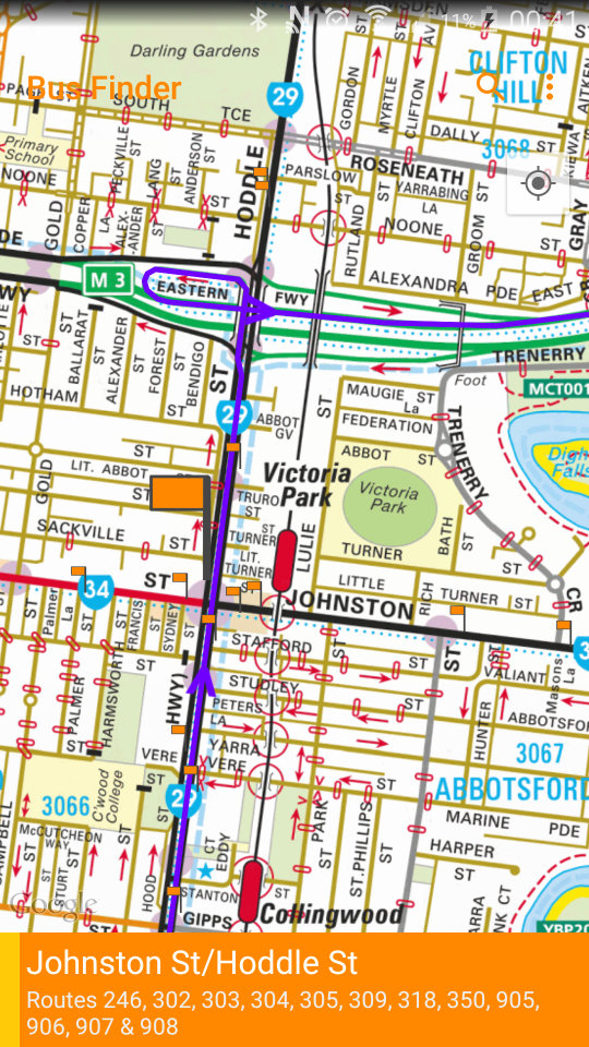
Bus routes from Johnston St/Hoddle St, including the route 907 in purple

Disruptions pushed from the PTV API
Other key features:
- See upcoming buses for every route at any stop
- Realtime information for selected routes
- See the detailed timetable for a particular run
- Search by route name/number or stop
- Save favourite stops
Upgrade to Pro (in-app) for:
- Notifications with upcoming departure times when you’re near favourite stops
- Disruption notifications for your bus routes from PTV and bus operators
- Android Wear support with map & directions
- Homescreen widget shortcuts to favourite stops

Stop notification with upcoming departures on phone and Android Wear
Melway maps used with kind permission of Melway Publishing

You must be logged in to post a comment.